A One-Two Punch of Winter Storms Engulfs the United States
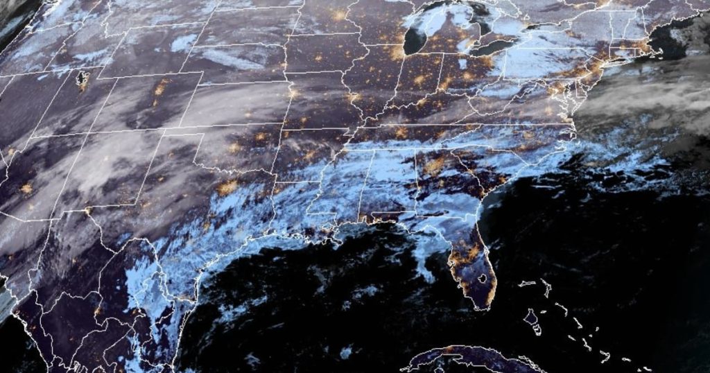
The United States is bracing for a pair of powerful winter storms this week, delivering a formidable combination of snow, freezing rain, and arctic cold across the country. By Monday, over 96 million people were under some form of winter watches, warnings, or advisories, spanning from coast to coast. The first storm is expected to develop across the central Plains, bringing rain and light icing to Oklahoma and Arkansas before shifting east. By Tuesday, it will unload moderate snowfall from Kentucky to Maryland, with the mid-Atlantic region likely receiving the highest snow totals—3 to 6 inches, with isolated areas potentially seeing up to 8 inches. Washington, D.C., and Baltimore are forecast to receive 4 to 6 inches of snow, accompanied by a treacherous layer of ice, while Philadelphia may see 2 to 3 inches. New York City is preparing for 1 to 2 inches of snow, though some areas could accumulate up to 4 inches.
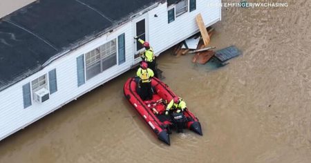
The southern side of this storm system will bring heavy rain to parts of the South, with 1 to 3 inches of rainfall expected across regions like Arkansas, Tennessee, and the Carolinas. Cities such as Shreveport, Louisiana; Jackson, Mississippi; and Knoxville, Tennessee, are at risk of localized flooding due to the downpour. Meanwhile, the northern Rockies and High Plains are bracing for arctic cold, with temperatures plummeting 25 to 40 degrees below average. In Bismarck, North Dakota, life-threatening wind chills as low as -55 degrees Fahrenheit are forecast for Monday night into Tuesday morning, underscoring the dangerous conditions ahead.
The Second Storm Intensifies the Winter Assault
The second storm is set to follow closely on the heels of the first, beginning with light snow across Colorado, Nebraska, and Kansas on Tuesday night. By Wednesday, it will intensify, bringing moderate to heavy snowfall from Kansas to Michigan. Major cities like Kansas City, Des Moines, Chicago, Milwaukee, and Detroit are in the storm’s crosshairs, with significant snow accumulation expected. In Chicago, the heaviest snowfall is predicted to coincide with the Wednesday evening commute, with estimates suggesting 4 to 8 inches of snow. While the exact totals are still uncertain, the impact on daily life is expected to be significant.
Kansas City Mayor Quinton Lucas emphasized the severity of the situation, urging residents to stay indoors if possible, especially on Wednesday when the heaviest snowfall is expected. Missouri Gov. Mike Kehoe has already taken proactive steps, signing an executive order to relax regulations for heating fuel shipments and authorizing the deployment of the Missouri National Guard if needed. The storm will eventually move into Canada by Thursday, bringing snow to northern New England and rain to the Interstate 95 corridor, stretching from Boston to Raleigh, North Carolina.
A Third Storm Targets the West Coast
While the first two storms dominate the central and eastern United States, a third system is brewing off the West Coast. A low-pressure system in the Pacific is expected to funnel subtropical moisture into California, raising concerns about flooding, mudflows, and debris flows in fire-scarred areas. The Scripps Institution of Oceanography has warned that this storm, classified as an atmospheric river (AR-2 on a 1-5 scale), could deliver significant rainfall and flash flooding, particularly in vulnerable burn areas. Los Angeles’ emergency management department has cautioned that communities like Pacific Palisades, still recovering from recent wildfires, are at heightened risk of mudslides and flooding.
The storm is expected to hit the San Francisco region by Wednesday, with the heaviest rain arriving Thursday morning. As it pushes inland and reaches Southern California by Thursday afternoon, it could be accompanied by powerful wind gusts of 40 to 50 mph in mountainous areas. While the Sierra Nevada range may see 2 to 4 feet of snow at higher elevations, the primary concern remains the heavy rainfall and its potential consequences. Federal forecasters have described this as the wettest storm period in the past year, with parts of San Diego expected to see rain by Thursday and Friday.
Arctic Cold and Extreme Weather Conditions
The frigid temperatures accompanying these storms are equally concerning. The National Weather Service has issued extreme cold warnings for multiple regions, with parts of the northern Rockies and High Plains experiencing temperatures far below average. In Boulder, Colorado, the arrival of "the main chunk of arctic air" on Wednesday is expected to drop high temperatures into the teens. Meanwhile, in Bismarck, North Dakota, the dangerous wind chills of -55 degrees on Monday night into Tuesday morning highlight the life-threatening conditions for those exposed.
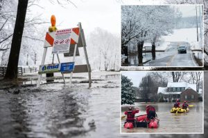
Travel is expected to become extremely hazardous, particularly during the Tuesday evening commute, as freezing rain spreads across the central Appalachians and mid-Atlantic states. The Weather Prediction Center has issued a slight risk of excessive rainfall for parts of the southern Plains and lower Mississippi Valley, with localized flooding a serious concern. Cities like Shreveport, Louisiana, and Asheville, North Carolina, are among those at highest risk.
A Country Already Reeling from Winter Weather
These storms come on the heels of a major winter system that swept through the Midwest and Northeast over the weekend, leaving behind a trail of disruption. The Northeast was blanketed in snow, with New York City’s Central Park and Boston’s skyline transformed into winter wonderlands. Boston Logan International Airport reported 5.5 inches of snow in just 24 hours by Sunday evening. However, the weather also brought significant challenges, including icy road crashes across multiple states and over 3,000 domestic flight delays on Sunday alone, according to FlightAware.com.
As the country contends with this new wave of winter weather, officials and meteorologists are urging residents to remain vigilant and prepared. From snow-dissolving salt treatments on roadways in Washington, D.C., to emergency declarations in Missouri, communities are taking proactive steps to mitigate the impact. The National Weather Service’s Dylan Flynn, a meteorologist in the San Francisco region, encapsulated the mood in a forecast discussion: “I coach the local high school track team, and we are planning to run through any rain Wednesday and Friday, but will certainly cancel practice on Thursday.”
Conclusion: A Week of Weather Extremes
The week ahead promises to be one of weather extremes, with two powerful winter storms, a third atmospheric river event, and arctic cold gripping much of the United States. While the exact path and intensity of these systems remain subject to change, one thing is clear: the potential for disruption is significant. From the heavy snowfall and freezing rain in the Midwest and East to the flooding and mudslide risks in California, millions of Americans are advised to stay alert, check on vulnerable neighbors, and prioritize safety above all else. As the storms unfold, the resilience and preparedness of communities will be tested once again.


