Severe Weather Systems to Impact Northern U.S. This Week
Week of Storms Ahead for the Northern United States
The northern United States is bracing for a challenging week as not one, but two powerful storm systems are set to strike in quick succession. Just as the remnants of a weekend storm begin to clear out of the Northeast, a new round of severe weather is gearing up to bring snow, rain, and frigid temperatures to the region. The first storm system is expected to emerge from the Plains on Monday, delivering snow to the northern areas and heavy rain to the southern regions. Kansas appears to be in the direct path of the heaviest snowfall, with forecasts predicting accumulations of 2 to 5 inches across the state. By Tuesday, this system will extend eastward, impacting the Appalachian and mid-Atlantic regions, including Virginia, Washington, D.C., Maryland, and Delaware. These areas could see significant snowfall, with totals ranging from 3 to 6 inches.
Arctic Blast and Record Cold Temperatures
Adding to the misery, a separate storm system will follow on Wednesday, bringing another wave of widespread rain and snow to the Plains and Midwest before moving into the Northeast by Thursday. But the weather isn’t just about precipitation—temperatures are set to plummet across the Plains and Rockies. A blast of arctic air could drive temperatures down by as much as 10 to 40 degrees below average, with Montana and the Dakotas expected to bear the brunt of the cold. Temperatures in these states are forecast to remain below zero, with wind chills potentially dropping as low as -40 degrees. Cities like Seattle, Billings, Montana, and Portland, Oregon, may also experience record-low temperatures, leaving residents shivering.
Weekend Storm Leaves a Trail of Snow and Ice
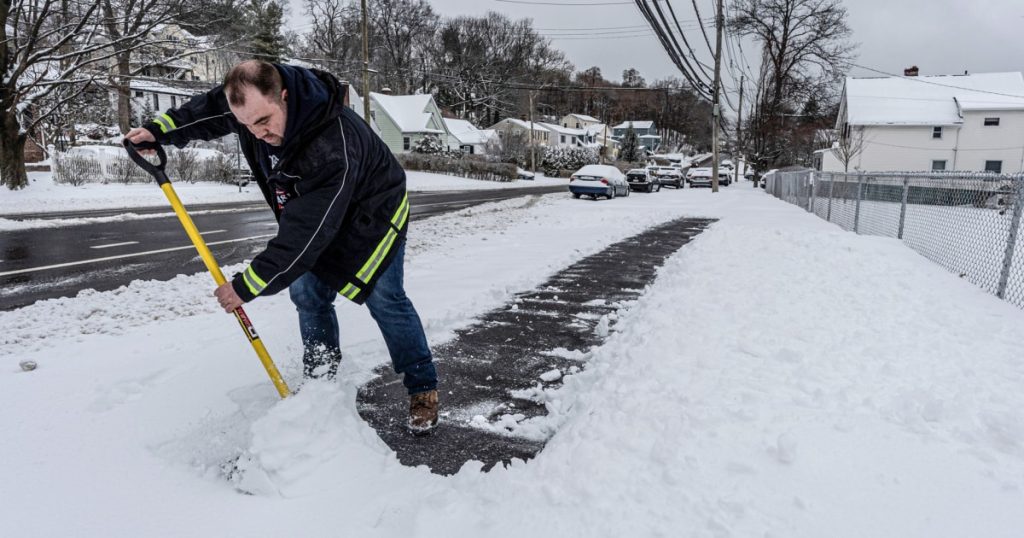
The upcoming storms come on the heels of a weekend weather system that brought snow, freezing rain, and icy conditions to the mid-Atlantic and Northeast. New York City’s Central Park was transformed into a winter wonderland, with about 3 inches of snow by late Sunday morning. Visitors flocked to the park, crafting makeshift sleds and enjoying the rare snow-covered landscape. In other parts of New York, snowfall totals were much higher. Ballston Spa, located in the state’s Capital Region, recorded an impressive 14 inches of snow by late morning. Meanwhile, in Rockland County, the snowfall was so heavy that it obscured road lanes, leading to hazardous driving conditions and at least one SUV spinning out.
Frozen Fun and Travel Disruptions
Despite the challenges posed by the weather, some residents found joy in the winter conditions. In East Petersburg, Pennsylvania, a man tested the ice on his driveway by sliding a hockey puck across it, capturing the moment on video. In Freedom, New Hampshire, the community awoke to a thick blanket of fresh powder, with a nearby weather station recording nearly 10 inches of snow in a 24-hour period. Boston Logan International Airport also reported significant snowfall, with 5.5 inches accumulated by Sunday evening. The snow-covered rooftops and swirling snowflakes created a picturesque scene across the city.
Lingering Cold and Record Snowfall
The weekend storm not only brought snow but also caused significant disruptions to travel. According to FlightAware.com, 416 flights were canceled across the U.S. by Sunday evening, with the majority of disruptions occurring in the Northeast. Additionally, 3,245 domestic flights were delayed as the low-pressure system moved off the coast. While winter alerts have been lifted in the Northeast, some lingering snow showers may persist into Sunday night. The weather service office in Burlington, Vermont, noted that Mount Mansfield, the state’s highest peak, has received 78 inches of snow this season—nearly 2 feet above average for this time of year.
Cold Snap to Continue into February
Looking ahead, the National Oceanic and Atmospheric Administration (NOAA) forecasts that temperatures will remain colder than usual across the northern United States for the next one to two weeks. The National Weather Service’s Bismarck, North Dakota, office emphasized that any hopes for a substantial warmup will have to wait, as arctic air is expected to keep temperatures well below normal through the third week of February. For now, residents in the northern U.S. should prepare for a prolonged period of cold weather, with more snow and ice on the way. As the National Weather Service celebrates its 155th birthday, its critical role in monitoring and predicting severe weather events has never been more apparent. Stay safe, stay warm, and stay informed!


